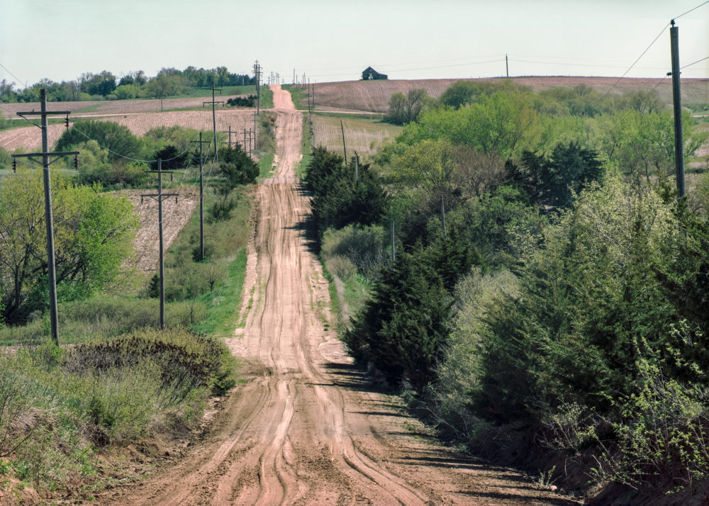

The Bohemian Alps…
is a region of gently rolling loess hills that sits like an overturned shallow basket on the table of eastern Nebraska between the Platte River to the north and the capital city of Lincoln’s salt flats to the south, David City to the west and Wahoo to the east. Its outlines are easy to see on topographic maps. The hills were formed when the last ice age ended and windblown deposits of fine yellowish colored material accumulated at the retreating margins of the ice sheets. The term “loess” comes from a German word meaning loose. The soil is fragile, friable and highly subject to erosion.
Prior to Euro-American settlement this grass-covered dome of hills and rich web of incised valleys held an abundance of game and plant life and provided a storehouse for the native tribes of the region. The Pawnee and their ancestors built a number of villages in the nearby Platte and Loup valleys. An important Pawnee sacred site known as “Pahuk Hill” or “Pahuka” sits on a bluff overlooking the Platte floodplain on the northern edge of the Alps. This high ground figures into the Pawnee’s creation stories and is home to animal spirits that help humans.
Once the region was overtaken by whites two of the north draining creeks just west of Pahuka got English names based on the large number of Native gravesites nearby: Bone Creek and Skull Creek.
Two of the biggest streams are named for common prairie trees and flow south and east: Cottonwood Creek and Oak Creek, which provides water for Lancaster County’s largest reservoir, Branched Oak Lake. Sand Creek and Duck Creek also head the same general directions eventually joining the areas’ largest stream, Wahoo Creek which drains the southeastern quadrant of the Alps and then flows to Salt Creek which joins the Platte near Ashland.
Today the Bohemian Alps is home to a great many small farms and cattle operations. Because the terrain is so hilly and cut by so many drainages it is not conducive to center pivot or gravity irrigation. It has escaped the fate of the flatlands nearby. A visitor driving the gravel roads will notice the many Czech names on the mailboxes and on the gravestones in the small community cemeteries.


Many Bohemian Alps farming families are still on places originally settled by their Czech or Moravian immigrant forbears in the 1870s and 1880s. Those early settlers were in the first wave of an immigration flow that continued steadily through the middle of the twentieth century, making Nebraska today the state with the highest percentage of Czech ancestry.
Hanging on hasn’t always come easy. Dry land farming can be risky. The young people tend to leave for the bigger cities. The small towns along the spines of the old rail lines may have a few open businesses, a tavern or café, maybe a welding shop and a grain elevator. It seems as though the Catholic churches and schools are the most important reason for little towns like these to still exist.
Thank you for so lovingly photographing this area. I especially love the photo of the dirt roads cut into the hills, and the abandoned farmsteads, though the sight can be melancholy. I visited my grandparents and cousins in this area 50 years ago and some of my earliest memories are from there.. We are planning to return for a visit, and your photos whet my appetite for more.